
Transportation is not just about moving people from one place to another. It also influences the way those places develop, look and function. One reason many cities and states have pursued rail and other forms of rapid transit in recent years is to create more walkable, tight-knit and environmentally friendly communities. Additionally, making sure more people have access to more opportunity is a critical factor in mobility planning in U.S. metros.
For years, traffic engineers have measured how well highways perform at moving vehicles using a metric known as level of service (LOS). Much like teachers grade papers, LOS has assigned a letter grade to a highway segment based on how freely traffic is moving on it at a point in time: “LOS A” represents traffic flowing freely at the road’s design speed, while “LOS F” denotes total gridlock.
California, the state long associated with the nation’s best freeway system, has invested heavily in rail, and more recently bus rapid transit since the 1960s. Today, all of the state’s largest metropolitan areas — Los Angeles, San Francisco/Oakland, San Diego, San Jose and Sacramento — have well-developed rail transit systems, and expansion projects are either underway or in the works for most of these.
Like the highways before them, these systems represent huge investments in California’s future. Measuring how well those investments in rail transit are performing is the purpose of a “transit scorecard” just released by Next 10, a public policy advocacy organization founded by venture capitalist F. Noel Perry that focuses on improving the quality of life for all Californians over the next decade and the decade after that.
Much as the LOS scores do with traffic flow on highways, “Grading California’s Rail Transit Station Areas” examines how well the neighborhoods within a half-mile of the state’s 489 rail transit stations approach the ideal level of development that generates the highest ridership. Ideally, a transit station should have a dense concentration of residents, shops and services, employment centers or a mix of these within a half-mile radius in order to promote maximum use of the facility and keep public subsidies to a minimum. Next 10’s report argues that state and local rules and regulations prevent many stations from reaching their full potential while keeping housing unaffordable and contributing to air pollution.
The report gives grades to both individual stations and systems as a whole based on 11 factors, including transit use by residents and workers, density of jobs and residences, walkability, policy support for transit-oriented development, transit affordability and greenhouse gas emissions. Stations themselves were also classified by the type of development that predominated around them: primarily residential, primarily commercial or mixed.
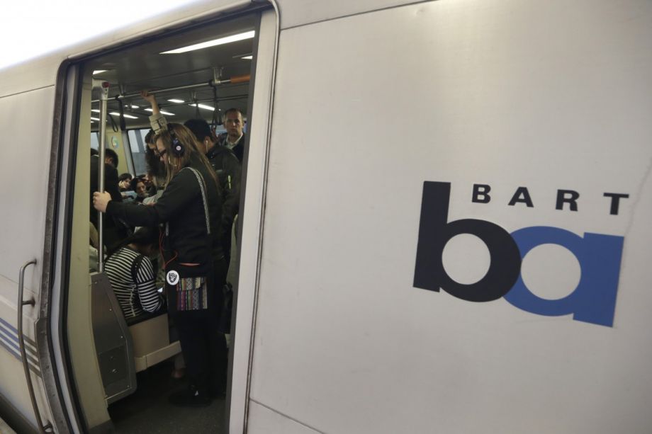
According to the report, the best-performing agency overall was the San Francisco Municipal Transportation Agency, which received an average grade of B. Bay Area Rapid Transit (BART) received a grade of B-minus, and the Los Angeles Metro and Sacramento Regional Transit systems both averaged a C. Bringing up the rear were the Santa Clara Valley Transportation Authority (VTA) in San Jose and San Diego’s Metropolitan Transit System (MTS), both of which received C-minus grades.
As for individual stations, the area around the Church Street station on the MUNI Metro Market Street subway got the highest grade: A-plus, scoring 93.8 out of a possible 100 points. It’s located in a densely developed area with a walk score of 97, where policies encourage transit-oriented development. Moreover, nearly 40 percent of households in the mostly residential area own no cars, meaning they rely heavily on transit.
The score breakdown for San Francisco’s Church Street station, according to “Grading California’s Rail Transit Station Areas”
Bringing up the rear is the area around Gillespie Field station in San Diego. Less than 5 percent of both residents and workers in this mostly commercial district use transit, which might not be surprising given its low walk score. Zoning rules in the area aren’t designed to change this, either, and the high level of car ownership contributes to high greenhouse gas emissions per household. All this adds up to 23.5 points out of a possible 100 and a grade of F.
The score breakdown for San Diego’s Gillespie Field station, according to “Grading California’s Rail Transit Station Areas”
Both BART and the LA Metro also had station areas that got A-plus and F scores as well, as the grades were assigned on curves for each neighborhood type. The highest-scoring San Diego station neighborhood, 12th & Imperial Transit Center, scored a B; Sacramento’s top performer, 7th and K streets, received an A-minus, and the Japantown/Ayer station in San Jose, that system’s best, earned a B-plus grade. Only MUNI had no stations with F grades; its worst performer, Third and Marin streets, got a D grade.
The best and worst transit stations areas in each California metro, according to “Grading California’s Rail Transit Station Areas”
The report notes that some poor-performing stations may have other attributes that generate ridership, like San Francisco International Airport, the worst-scoring station on BART. But all of the stations that earned A or A-plus grades have one thing in common: They are located in densely developed neighborhoods that predate the era of auto-centric development.
The Works is made possible with the support of the Surdna Foundation.

Next City contributor Sandy Smith is the home and real estate editor at Philadelphia magazine. Over the years, his work has appeared in Hidden City Philadelphia, the Philadelphia Inquirer and other local and regional publications. His interest in cities stretches back to his youth in Kansas City, and his career in journalism and media relations extends back that far as well.
Follow Sandy .(JavaScript must be enabled to view this email address)


