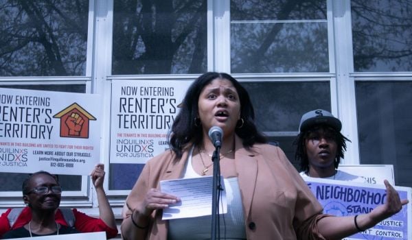
Like many U.S. cities, Minneapolis is taking a hard look in the mirror and asking itself whether the past honored in public spaces is one that the city wants to celebrate.
In May, Minneapolis’ park board voted to recommend changing the name of Lake Calhoun, named for the former vice president and staunch defender of slavery, John C. Calhoun, who lacks any strong connections to the state of Minnesota, to Bde Maka Ska, the Dakota name for the body of water. In June, after a campaign by students, the school board voted to rechristen Alexander Ramsey Middle School — its namesake, a former Minnesota governor, had called for the extermination of the Sioux tribe — as Justice Page Middle School, after the first African-American on the Minnesota Supreme Court, Alan Page. And while prominent monuments have attracted headlines across the country, a group of researchers working out of Augsburg University in Minneapolis is taking on a less visible legacy: thousands of racially restrictive covenants in house deeds buried in the city’s property records.
Their project is called Mapping Prejudice. Their goal is to find every single racially restrictive covenant — a now-illegal type of deed restriction that prevented the sale of a home to a black person or, in some cases, anyone other than a white person — and plot them on a map of Minneapolis. The early results show, not too surprisingly, that the neighborhoods where racial covenants were clustered in the early part of the 20th century are still some of the city’s whitest.
“My mission with my work on this subject was really inspired by what seems to be a contradiction,” says Kirsten Delegard, a scholar-in-residence at Augsburg and creator of The Historyapolis Project, of which Mapping Prejudice is an offshoot.
Minneapolis has traditionally regarded itself as a “model metropolis,” Delegard says: a relatively affordable place with world-class parks, a strong economy and a tradition of volunteerism. But, as Delegard says and as Politico detailed last year, the city also has some of the worst racial disparities in the nation. The goal of Delegard’s project is to confront the grand narrative of the Twin Cities head on, and reveal the racist underpinnings of what many Minneapolitans believe to be a city that was never segregated in the way cities in the South were.
Although racially restrictive covenants have been outlawed since the Fair Housing Act was passed in 1968, and rendered null some years before that, other cities have attempted to uncover and in some cases expunge them from property records. Delegard says that her project was inspired by one in Seattle, which helped inspire a change in state law, making it easier for homeowners associations to formally get rid of the restrictions. They’ve been the subject of scrutiny in Charlotte and Los Angeles, and a group in Washington, D.C., has sought to map them too.
But the Minneapolis project claims to be the “first-ever comprehensive map of racial covenants for an American city.” Kevin Ehrman-Solberg, a GIS specialist and project manager for Mapping Prejudice, says it’s only possible because the city of Minneapolis has digitized all of its property records. Ehrman-Solberg says he is using optical character recognition software and his own script to comb the deeds for certain keywords, some of them stark red flags of racist covenants. The deeds in some cases are remarkably specific: for example, a property “shall not at any time be conveyed, mortgaged or leased to any person or persons of Chinese, Japanese, Moorish, Turkish, Negro, Mongolian or African blood or descent.” The work is only possible with the help of online volunteers, Ehrman-Solberg says.
According to Ehrman-Solberg, clusters of restrictive deeds correlate not only with white neighborhoods, but also with high property values. It stands to reason, considering that many neighborhoods have found ostensibly “race-blind” ways of locking demographics in place in the decades since explicit discrimination became illegal.
Becky Nicolaides, an independent scholar and research affiliate at the UCLA Center for the Study of Women who has studied suburbanization in Los Angeles, says that overt racial discrimination has been supplanted in many cases by “spatial politics.” A record like the one that the Mapping Prejudice team is working on is “intrinsically valuable,” Nicolaides says, but doesn’t necessarily get at the sometimes insidious policies — from land use restrictions to aesthetic and landscaping regulations — that serve to lock class-based segregation in place today.
“The contemporary metropolis is pretty complicated,” Nicolaides says. “And I think while it’s great to have this document of racially restrictive covenants, I feel like there’s more complex dynamics that are happening that are wielding way more power now than the residue of what those covenants did.”
Delegard says the most common criticism she receives about Mapping Prejudice is that her team is focused on the past, and digging up documents that have been legally null for decades. But she believes it’s important especially in a place like Minneapolis to illustrate that housing patterns that some might want to believe are natural, or the result of preference, are founded on racist policies.
“If you’re going to make policies that take aim at the racial disparities today, it’s very important to understand how they were created,” Delegard says. “If we are going to have the political will to put those remedies in place, people are going to really have to grapple with the past in a truthful way.”

Jared Brey is Next City's housing correspondent, based in Philadelphia. He is a former staff writer at Philadelphia magazine and PlanPhilly, and his work has appeared in Columbia Journalism Review, Landscape Architecture Magazine, U.S. News & World Report, Philadelphia Weekly, and other publications.
Follow Jared .(JavaScript must be enabled to view this email address)