Have you ever walked beneath an overpass and seen a mural or simple gathering of benches and shade plants in the gloom? There’s something thrilling, secretive and even populist about the experience — encountering space reclaimed for people beneath a monument to cars, commerce and GDP.
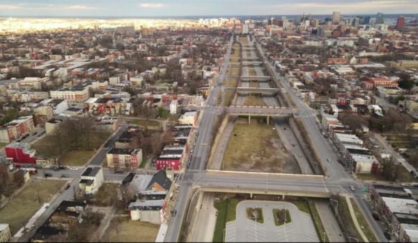
Today, spaces like these are the subject of a new report from two organizations: New York City’s DOT and the Design Trust for Public Space (the people responsible for this 2002 study, which helped kick off NYC’s High Line restoration). “Under the Elevated” explores the aesthetic and social implications of New York’s elevated railways and roadways, which total about 700 miles citywide.
Front-and-center is an acknowledgement that such structures have historically cast a long shadow, both literally and figuratively.
“Our 700 miles of remarkable elevated infrastructure have clearly contributed to the expansion and economic growth of New York City,” reads a preface from the city DOT. “But that infrastructure has also negatively impacted many communities, especially low-income and minority neighborhoods physically separated and isolated by elevated highways and rail lines.”
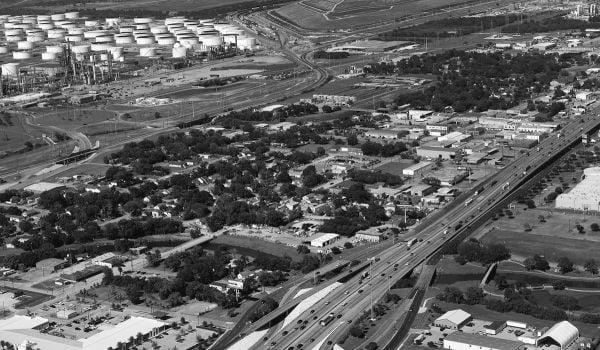
New York’s elevated throughways may not be St. Paul’s I-94 — which bulldozed the city’s largest black neighborhood in the 1960s — but even if their construction didn’t raze whole communities, it didn’t exactly raise property values either. As historian Thomas J. Campanella writes in one section of the report, they’re “almost always a blight in the city, for they were built to get people in and out of town and offer little but darkness and pigeon excrement in the streets below.”
Meanwhile, that below-space is massive on a city-wide scale: about four times the footprint of Central Park.
“In a dense city like New York, the residual space beneath the nearly 700 miles of elevated transportation infrastructure can no longer be an afterthought,” the report states, adding that the dark and “blighting” structures also represent “an untapped public asset that has the potential to radically transform New York’s urban fabric.”
According to Design Trust Executive Director Susan Chin, transformations will rely on collaborations with each borough around one unifying theme: how those spaces function as “connectors or corridors.” Inspired by several pilots started in 2009, one on Division Street under the Manhattan Bridge, the other under the 2/5 elevated subway line in the Bronx, Chin says the organization went to New York’s DOT.
“They said ‘We need to be thinking about this space in a very different way,” she recalls, adding that agency wanted the els to function as gateways to each borough and establish a strong sense of place.
“Not every neighborhood is going to have a High Line and not every neighborhood needs a High Line, but they do need safer environments — not a dark, dirty, trash-strewn space,” she says.
But, as the report explores, under-elevated spaces have also been the historic backdrop for tactical community-building efforts, from the skatepark under Brooklyn Bridge to the Puerto Rican market under the Metro-North rail line in East Harlem. With those examples in mind — and remembering, as I’ve written before, that the High Line inflated neighboring property values so much that it inspired several studies on gentrification — tough questions about ownership, community involvement and the possibility of displacement need to be asked. How will a massive public improvement process really affect those closest to the els? Who gets to define “improvement”? Who gets to define “blight”?
To its credit, the report doesn’t shy away from these questions. For both early pilots, Design Trust partnered with neighborhood-level organizations — Chinatown Partnership in Chinatown and WHEDco in the Bronx. Empirical research, on-street surveys and regional insight from the partners informed both projects, the report states, which were then tested in pop-up form, rather than built permanently right away.
“Our goal in applying to the Design Trust for the pilot initiative was to look at ways to respond to community needs,” says Kerry A. McLean, director of community development with WHEDco. Concerns the organization saw included safety, lighting, noise from the train above and a lack of seating at bus stops.
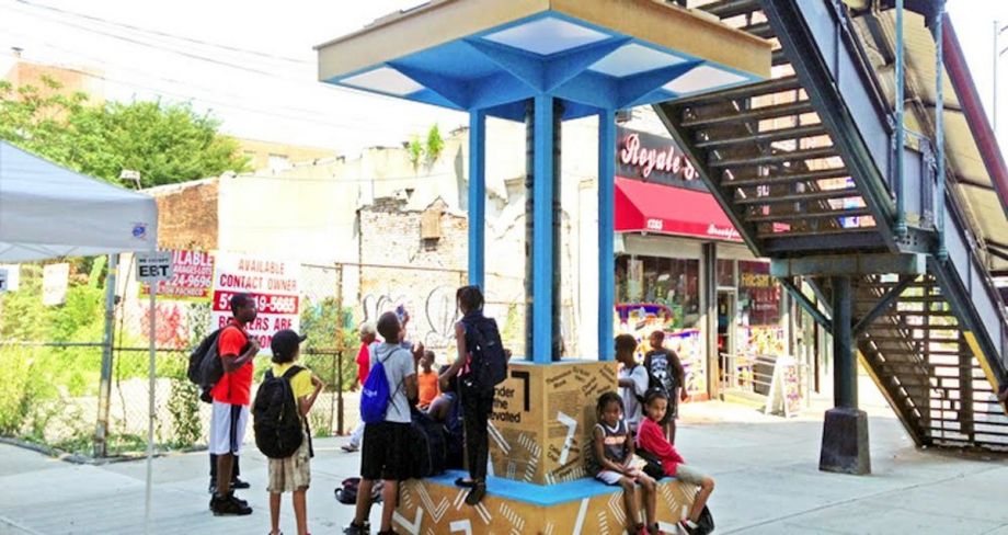
The installation that Design Trust and WHEDco came up with was a bright blue, LED-lit seating booth playing music from Bronx artists — Ray Mantilla, Rebel Diaz, Akua Dixon & Quartette Indigo. The so-called “Boogie Down Booth” created a gathering place with lights and seating, and the music helped mute the noise from the subway platform above.
“In our case, the issue of gentrification isn’t relevant,” McLean says, speaking specifically about the installation. “[The Boogie Down Booth] only exists because of the community. It doesn’t take from beyond and ‘put in,’ it actually leverages resources from the ground up.”
Going forward, the report outlines several study sites, and Chin says the rigorous engagement process will continue, complete with pop-ups that demonstrate an exhibit’s potential to passersby.
“When you can improve the ground plane, you re-knit the fabric of the neighborhood together,” she says.
In the places where connections have already formed organically, the report pledges to honor them — not sweep them away.
“Informal use, and the inherent value of the city’s “leftover” spaces beneath elevated infrastructure that inspire such use, must be considered,” it states.
The Works is made possible with the support of the Surdna Foundation.

Rachel Dovey is an award-winning freelance writer and former USC Annenberg fellow living at the northern tip of California’s Bay Area. She writes about infrastructure, water and climate change and has been published by Bust, Wired, Paste, SF Weekly, the East Bay Express and the North Bay Bohemian
Follow Rachel .(JavaScript must be enabled to view this email address)