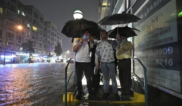
When it comes to rising sea levels and increased flooding risk in many coastal cities, maps are crucial for disaster response and disaster mitigation. Local agencies use them to help predict who must evacuate and where to begin directing resources. They’re key to building urban resilience.
Some communities already have inundation maps — some provided by National Oceanic and Atmospheric Administration (NOAA) and some generated by local agencies — but these are often misunderstood by the public. Or, they’re “low resolution,” meaning they show large blotches where floodwaters might rise, but cannot predict in detail where the water will go.
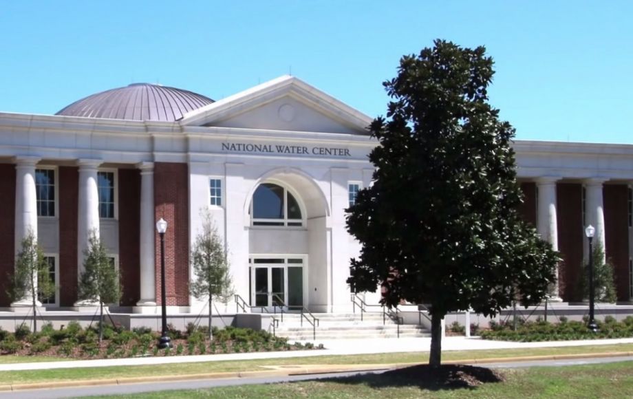
NOAA wants to come up with a national model that will be able to warn people if their homes or communities are in danger of flooding. “We want to be at the street level,” says Sam Contorno, a physical scientist at NOAA’s new National Water Center.
The Water Center opened in Tuscaloosa, Alabama, in May, and is described in a NOAA press release as “the nation’s first facility dedicated to water forecasts, research and collaboration across federal water science and management agencies.”
“We’re basically generating a flood prediction framework…[which] will allow us to predict floods several days in the future, at a high-level resolution,” Contorno explains. “It will be a considerable improvement over what we’re doing. It’s transformative.”
So instead of the National Weather Service (which is part of NOAA) sending out a generalized “flash flood” alert to multiple counties, they may be able to predict, block by block, which streets in a city are at risk of flood, days before the rain begins to fall.
“Instead of points along the river, we’re going to be going down to a stream level, to the street level,” Contorno says.
All this extra data will do for flood prediction what big data has already done for predicting the weather. As meteorologists gain access to ever more sensors collecting local data on temperature, pressure and wind speed, weather forecasts have gotten more accurate.
Hydrology models have lagged behind meteorological models, because of the complexity, Contorno says. Predicting the state of the atmosphere, he notes, requires knowing about large features — clouds, mountains, oceans. But predicting where water will go requires knowing where there are buildings, pavement and drainage culverts. In other words, these are micro features that need to be accounted for to predict floods. But, he says, “we have the horsepower, so to speak. We now need to … develop a national model.”
The Water Center officially opened May 26th, and the team is ramping up, hiring employees. But they’re also already working on a few projects, working with the Tuscaloosa fire department and working to launch a project with the fire department in Austin, to find out what interfaces and products would be most useful for emergency managers.
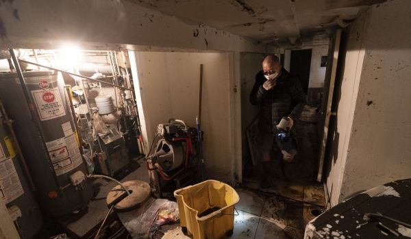
Even with a street-level tool, there will still be uncertainties, and those uncertainties can still be the difference between success and failure. In 1997, the National Weather Service predicted that the Red River, which bisects Grand Forks, North Dakota, would rise to 49 feet. Grand Forks’ levees were 52 feet high, and the water — well within NWS’s margin of error — hit 54 feet, causing billions of dollars of damage and damaging 75 percent of homes.
Had NWS made the uncertainty clear, those levees could have been reinforced with sandbags or officials could have attempted to divert the overflow to a less populated area. The good news is that since that flood in 1997, the service has learned the importance of communicating uncertainty (think of maps showing a hurricane’s path, which instead of showing a straight line, show a cone that widens as the path becomes less of a sure thing). And the new center will also share information with a healthy dose of uncertainty.
The model will also assist with other water-related queries: If NOAA knows how a local water table is doing, they can better predict how a community will respond to a period of no rain. “You have to know what’s going on in the soil,” says Contorno.
The center could even help with water quality issues, using new hydrology models to better pinpoint where pollution may enter a water system. “There could be farming in the upper Midwest that includes chemicals, fertilizers, whatever,” Contorno says, “and if there is a big flood, then some of those nutrients from the fertilizer can get washed down the river and flow all the way out into the Gulf.”
“If we can forecast the water flow, we can do a [more] accurate job of predicting water quality.”
The Works is made possible with the support of the Surdna Foundation.

Rachel Kaufman is Next City's senior editor, responsible for our daily journalism. She was a longtime Next City freelance writer and editor before coming on staff full-time. She has covered transportation, sustainability, science and tech. Her writing has appeared in Inc., National Geographic News, Scientific American and other outlets.
Follow Rachel .(JavaScript must be enabled to view this email address)


_1200_700_s_c1_600_350_80_s_c1.jpg)