After months of prodding by livable streets activists in the 2013 Democratic mayoral primary for New York City, candidate Bill de Blasio made an incredibly ambitious campaign promise: His administration would strive for zero traffic deaths.
Now in office, de Blasio hopes to deliver on that goal with a comprehensive multi-agency plan called Vision Zero. On Tuesday his administration rolled out the specifics, which call for a 25-mile-per-hour speed limit on most city streets, more 20-mile-per-hour zones in neighborhoods, more automated speed camera enforcement, and redesigns of more than 50 intersections and corridors throughout the city.
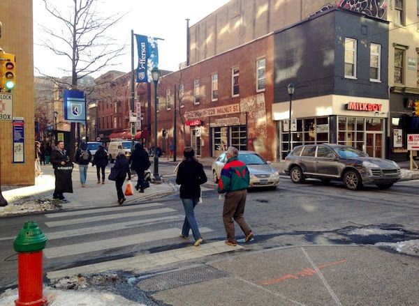
Here in Philadelphia, the issue of pedestrian crashes has largely failed to earn the status of a political issue, partly because there is no broad coalition here analogous to New York’s well-organized livable streets movement, but partly because there has not been usable data on the problem — until now.
Using geospatial data from the Pennsylvania Department of Transportation on crash locations in Philadelphia County between 2008 and 2012, Daniel McGlone of the GIS firm Azavea and I were able to identify 10 of Philly’s worst intersections and street segments for pedestrian crashes, based on this interactive map Daniel created:
Over the given five years, Philadelphia witnessed 8,690 crashes involving 9,051 pedestrians. These crashes caused 376 major injuries and 158 deaths. As the map shows, most segments saw only one or two pedestrian crashes, but some streets produced many more. Here are 10 of the worst:
1. Chestnut Street between 10th and 18th streets: 46 pedestrian crashes

The 1200 and 1600 blocks of Chestnut Street were both in the top-10 list of pedestrian crash locations, with 14 and 10 crashes, respectively. The segment between 10th and 13th streets also made the top-10 list for all crashes, with 35 collisions between 2008 and 2012.
The Center City street grid has an overall lower rate of crashes than lower-density, more auto-oriented areas of Philadelphia, but Chestnut Street’s numbers are weirdly high. It has two fairly narrow travel lanes, one of which is a shared bus and bike-only lane (though it’s rare to see this enforced), and there’s a curb parking lane separating pedestrians on the sidewalk from the car travel lane. Curbs bump out slightly at the intersections as a traffic calming measure.
So why does Chestnut have more crashes? It seems possible that, as a major downtown shopping district, it simply has more foot traffic. People jaywalk across the middle of the block, step into the intersection before the light turns, and so on.
Still, if we were taking a Vision Zero approach, we’d take responsibility for the design of this space rather than blame pedestrians. To discourage jaywalking, we could stop cluttering so much street furniture (newspaper kiosks, trash cans, bus shelters, signage) right at the crosswalks, and scatter those along the south side of the street along with more bike racks, planters and street trees. At the intersections, pedestrians could be given signal priority, rather than giving cars and pedestrians the green light to go at the same time.
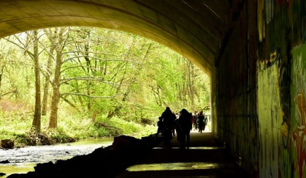
2. 9th and Market streets: 27 pedestrian crashes
This is the underpass through The Gallery complex on 9th Street between Market and Filbert streets. There were 12 pedestrian crashes on this segment out of a total of 27 pedestrian crashes around the intersection of 9th and Market.
It’s easy to see why this space is so dangerous. It’s dark, which makes it hard for drivers to see pedestrians, and the lanes are wide enough for cars to travel at higher speeds than normal in the city. Yet this is supposed to be a pedestrian crosswalk area. Narrowing the lanes and raising the road surface at the crosswalk could be a good way to slow cars down, and lining the ceiling with LED lights would make it easier for drivers and pedestrians to see each other.
There’s been talk of The Gallery undergoing a big makeover at some point, and the city could help that along with safety upgrades and beautification of the public space around it. This property will be a more lucrative redevelopment interest in a much safer environment.
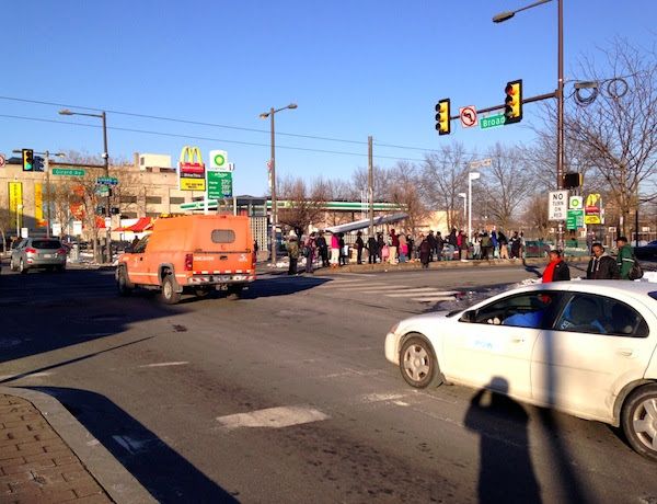
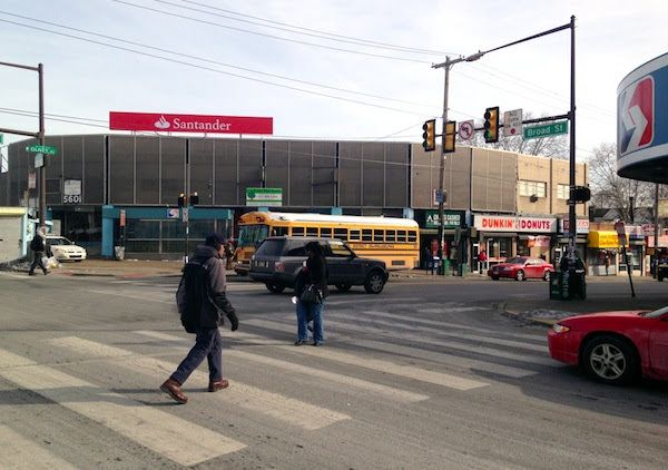
3. Broad Street and Snyder Avenue: 24 pedestrian crashes, 1 pedestrian death
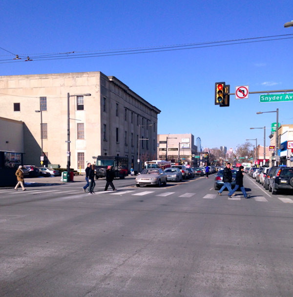
Broad Street is the biggest problem for pedestrian safety in Philadelphia. Five of the top 10 crash locations are on blocks directly off this main thoroughfare, and the 2100 block of Broad makes six. All these locations are near stations on the Broad Street subway line, so there is more concentrated pedestrian traffic.
Car travel lanes along Broad are wide and engineered to maximize throughput and fast travel speeds. Despite the massive amount of road space, there are six lanes for cars and no dedicated lanes for bikes or buses. Even the median, which in some segments functions as a halfway stopping point for pedestrians, is used in parts of South Philly as an informal parking lane.
This creates a dangerous situation where pedestrian sightlines are interrupted. Such is the situation on the 2100 block of Broad Street, where 10 pedestrian crashes and one pedestrian death took place, along with eight more crashes on other streets in this intersection:
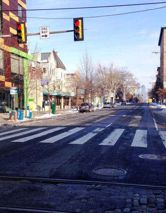
4. 34th and Spruce streets: 10 pedestrian crashes

This area is right on the University of Pennsylvania campus and has a lot of foot traffic. The city has already introduced some pretty timid traffic calming measures here — small curb bumpouts seem to be the extent of it — PennDOT data shows that this remains one of the city’s most dangerous street segments for pedestrians. More ambitious curb bumpouts at this intersection and signal priority for pedestrians would be appropriate, as well as bike racks, street trees and news kiosks in the middle of the blocks to discourage jaywalking.
5. Chestnut Street between 34th and 41st streets: 24 pedestrian crashes
Down the street from the Market-Frankford elevated train stops at 40th and 34th streets, and featuring lots of street-level storefronts, this segment of Chestnut sees a lot of pedestrian traffic. Unlike Chestnut Street in Center City, the travel lanes are very wide and fast speeds for cars are this road’s top priority. Narrower and fewer lanes and shorter crosswalks could help calm traffic speeds and increase mutual awareness between cars and pedestrians.
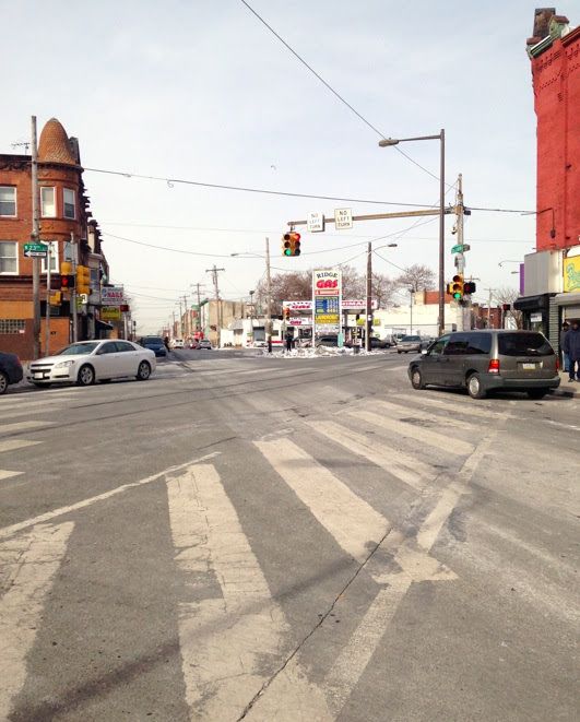
6. Broad Street and Girard Avenue: 17 pedestrian crashes
One recurring issue with this analysis is that joining the crash locations to street segments on the map obscures where some of these crashes are happening. In this case, the 1300 block of Girard looks like the culprit, but many of these happened near the intersection of Broad Street.
If Azavea’s earlier map of bike crash locations is any guide, it seems likely that the five bad crash locations directly off Broad Street are due more to Broad’s fast travel speeds, auto-oriented design and lack of signal priority for pedestrians than to the east-west streets. Still, there are issues with these streets that deserve attention, such as crowded trolley platform islands in the middle of the street.
These platforms could be much longer so that some people wouldn’t have to stand in the crosswalk, as you see in the photo. And it would not be as unnerving a wait if trolleys (the 15 line in the case of Girard) were given dedicated painted lanes rather than having to run in mixed traffic.
7. Broad Street and Lehigh Avenue: 17 pedestrian crashes
Broad Street has the same problems at every intersection, only more so at transit hubs that attract more foot traffic. This intersection doesn’t have any unusual features besides the same problematic auto-oriented characteristics — overly wide lanes, lack of signal priority, stingy curbs — that dog pedestrians all along Broad.
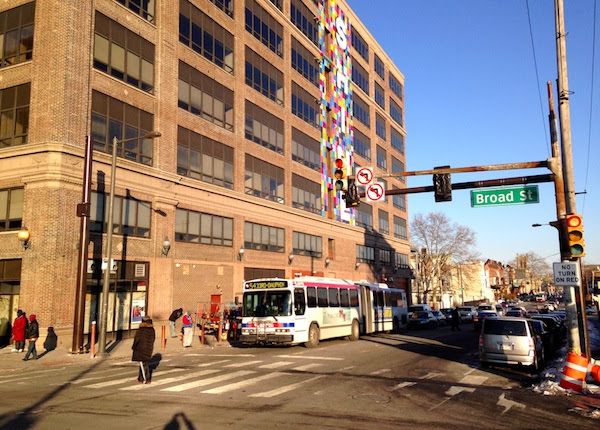
8. Broad Street at Erie and Germantown avenues: 23 pedestrian crashes, 2 pedestrian deaths
Germantown Avenue crosses Broad Street and Erie at a diagonal, creating an extremely wide intersection. This area is bustling with pedestrian foot traffic because of a nearby subway station and sizable cluster of retail businesses.
Reducing pedestrian crashes at this intersection would require the same traffic calming interventions needed all along Broad Street, but here the diagonal street crossing presents some additional opportunities for neckdowns that extend the curb further out into the street, calming traffic and shortening the time pedestrians have to spend in the roadway.
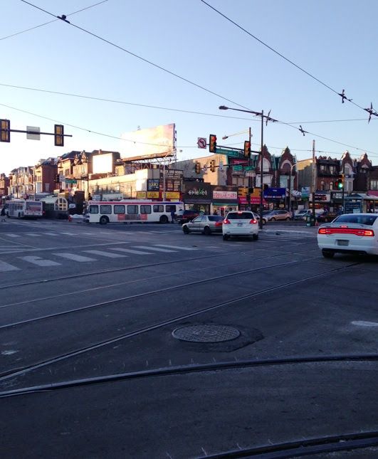
9. Broad Street between Olney and Chew avenues: 43 pedestrian crashes
SEPTA’s Olney Transportation Center, a major transportation hub, is here, and this area includes the street segment with the greatest number of crashes in the city — the 1300 block of Olney, with 21 crashes.
For some, the existence of the transportation hub as a magnet for pedestrian traffic will serve as a passable excuse for 43 pedestrian crashes in five years, but the Vision Zero perspective would say this is mistaken. A large number of pedestrians means it’s even more important to tame traffic and ensure that nobody gets hit. The major transit station means that cars have a weaker claim on the public right-of-way. If safety were taken seriously as a priority, that would be reflected in the amount of street space that cars are allocated in the area.
10. Cecil B. Moore Avenue between Ridge Avenue and 22nd Street: 8 pedestrian crashes
This is another overly wide intersection in North Philly where a diagonal street (Ridge Avenue) crosses the grid at a diagonal, creating confusion for both cars and pedestrians. In this case a neckdown would slow down cars turning through the intersection and shorten the distance pedestrians have to walk to cross the street.
Philadelphia’s political system has a bad habit of unthinkingly calling these events “accidents” and dismissing them as little more than an unfortunate and blameless side effect of our mobility system. The Vision Zero perspective regards this rationalization as nonsense.
Is it really possible to achieve zero crashes? Probably not. But this conception of the issue crucially takes responsibility for trying to reduce crashes by changing street designs, lowering levels of service for cars in problem areas, and automating speed limit enforcement. De Blasio has taken on this responsibility. Now that Philadelphia officials can see where our problems lie, it’s time for them to take responsibility, too.
All photos by Jonathan Geeting.

Jonathan Geeting is a freelance writer based in Philadelphia, where he writes about land use and public space politics. His work appears at Next City, This Old City and Keystone Politics.