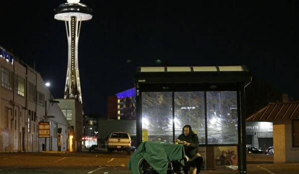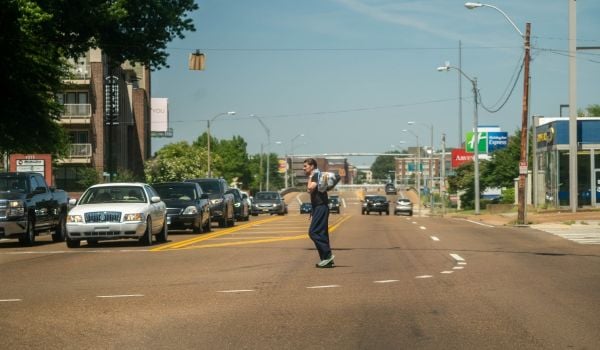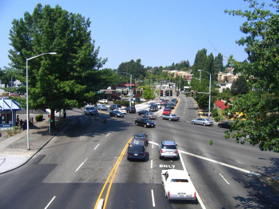
The intersection of Rainier Avenue and Martin Luther King Jr. Way in South Seattle’s Mount Baker neighborhood doesn’t work well for anyone. Cars bottleneck on both of the major streets while waiting through three full light cycles to turning lanes in both directions. Students at Franklin High School, whose sports fields sit in the eastern crook of the X created by the two streets, need to cross 12 lanes of east-west traffic to reach the Mount Baker light-rail station on the other side. There’s a pedestrian bridge intended to ferry them over, but it’s circuitous and steep — and not ADA compliant. At least 183 collisions occurred around the light-rail station and intersection between 2010 and 2013.
The station — though it’s surrounded by an island of concrete — looks shiny, new, if a little quiet. Opened seven years ago as part of Seattle’s Link Light Rail system, the Mount Baker stop was supposed to usher in a new era of transit-oriented development in the neighborhood. It sits in the middle of the North Rainier Urban Village, where the city of Seattle decided to focus development 20 years ago. While other urban villages have seen astronomic growth in that time, far exceeding targets, big change hasn’t come to Rainier, particularly around the station. The first development to take advantage of light rail, ArtSpace, is an affordable apartment complex and commercial space geared toward artists, located directly on the light-rail parcel. The building is fully occupied with galleries, a preschool, cafe and more, but without street life, businesses are struggling and no other projects have followed its example. “Rather than a thriving town center, the station area is defined by vacant lots and auto-oriented uses and lacks a defined character and sense of place,” reads a 2015 report assessing the success of the urban village.
“If we don’t get ahead of the game in terms of proactive leadership in placemaking, then places tend to make themselves, and not always in the most desirable way,” says Talis Abolins of the Friends of Mount Baker Town Center advocacy group. They’re lobbying for a host of improvements to solve the area’s interconnected problems: a dangerous traffic situation that discourages non-automobile traffic, the largest open space gap in south Seattle and a dearth of new investment despite a recent upzone.
“The traffic-dominated character of this landscape doesn’t lend itself to a town center,” says Abolins. “There’s certain things you need to bring in to the area in terms of public amenity and infrastructure before you actually foster the kind of transit-oriented development that was intended,” starting with that intersection.
The Seattle Department of Transportation (SDOT) has a plan for it, with initial funding secured by the Move Seattle levy, passed by voters last November. Accessible Mount Baker calls for a dramatic redesign that would effectively eliminate the intersection for through traffic. A car heading south on Rainier Ave. would, instead of crossing Martin Luther King Jr. Way to reach the southern part of the avenue, actually veer slightly right and continue onto what was once the southern section of MLK. Instead of two major roads crossing each other in an X, the roads would glance past each other here, separated by a new pedestrian plaza where the intersection once was. To cross from one major road to the other, cars would take two left turns onto a ladder street north or south of the former intersection. Both would be narrowed for vehicular traffic to allow wider sidewalks and bike lanes.
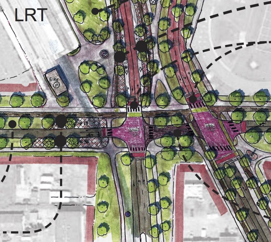
The redesigned intersection, with light-rail station in top left corner (Credit: SDOT)
Beyond the traffic-calming benefits and the return of pedestrians to street level, the new crosswalk would reconnect a historic Olmsted-designed parks boulevard severed by the car-centric intersection. The Olmsted brothers created a network of parks for Seattle in the early 1900s, including a snaking path of grassy boulevards linking Lake Washington in the west to Jefferson Park in the east. That wide boulevard is separated by a planted median. As part of Accessible Mount Baker, SDOT is proposing dedicating the lane north of the median to bike and pedestrian traffic, and maintaining two-way automobile traffic in the southern lane. Bikes and pedestrians will be able to cross the two major roads as part of a complete trail along the Olmsted boulevard. Transit and emergency vehicles will be the only motorized traffic allowed through.
Michael James, project manager at SDOT, says this is a unique approach for the agency. For the area around the station, SDOT purposefully created a modal hierarchy: pedestrians and cyclists first, transit second, followed by freight, shared mobility services like taxis, and plain old vehicle traffic last. The plan also calls for rerouting bus traffic from a loading area currently in use across Rainier Avenue so that buses would instead loop directly around the station, making connections easier.
James says SDOT is current evaluating the feasibility of the plan’s proposed components. He estimates the agency is four or five years away from starting full implementation, but right now they’re looking to install small aspects of the project that can improve conditions in the short term, with paint and bollards instead of concrete. Calling it the “2nd Avenue approach,” in reference to some speedy bike lane installations there, James asks, “Particularly are there safety elements that we can implement sooner without being a throwaway in the long term?”
Other changes may come as a result of expanded RapidRide bus rapid transit service along Rainier Avenue, also funded through the Move Seattle levy.
For Abolins, the potential change is everywhere he looks. He points out the vacant surplus Sound Transit property tucked under the rail line that could become a skate park, the triangular parcel between the streets that could become a mixed-use development. “There’s nothing here yet, so who’s going to be the first person to dip their toes in?” he asks. “It’s a place that’s waiting to be made and to happen.”
The Works is made possible with the support of the Surdna Foundation.
Jen Kinney is a freelance writer and documentary photographer. Her work has also appeared in Philadelphia Magazine, High Country News online, and the Anchorage Press. She is currently a student of radio production at the Salt Institute of Documentary Studies. See her work at jakinney.com.
Follow Jen .(JavaScript must be enabled to view this email address)