Rapidly developing, densifying cities like Seattle and Miami are seeing their skylines transform year by year, as new high-rises gobble up the sky.
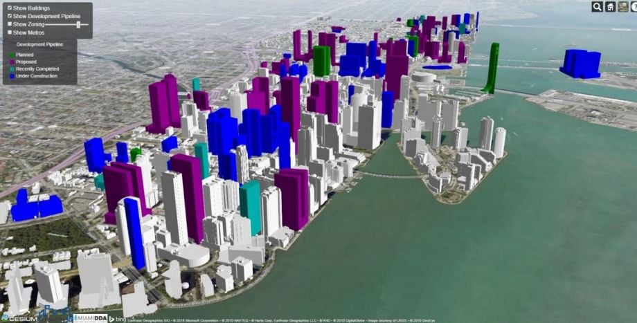
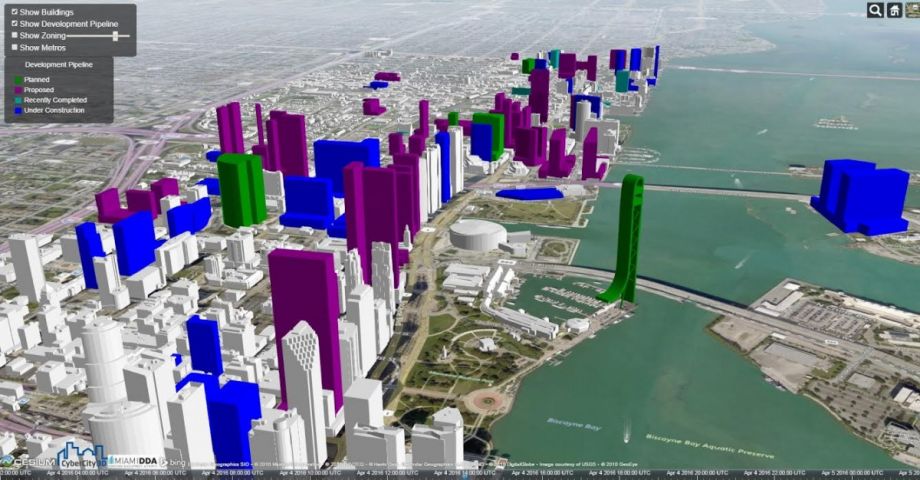
To visualize that changing profile, the Miami Downtown Development Authority has created a 3D map of the future skyline of the city’s downtown and adjacent Brickell neighborhood. Buildings recently completed, planned, proposed or under construction can be overlaid on the city as it is today. Viewers can toggle on and off zoning regulations, and click on a given property to see who is developing the project. (Condominiums mostly, by the thousands, plus apartments and hotels, a new science museum, a Latin American Art Museum, at least one project boasting a mega-yacht marina, and a luxury residential tower designed by the late Zaha Hadid.
In total, developers are on track to deliver more downtown units than Miami has seen in a decade. The image that emerges is of a building boom, albeit one smaller and less precipitous than the boom that bust in 2008. A report from late 2015 suggests that the current cycle of development is slowly coming to a close as the dollar grows stronger in relation to Latin American and European currencies. (International buyers flooded the market around 2011 while the dollar was weak.)
Amid this growth, a Zillow blog post in late 2015 forecast hyper-gentrification for Brickell, and in other neighborhoods, many longtime residents continue to worry about displacement.
About 4,000 units are expected to hit the downtown market this year, followed by 3,300 in 2017, according to the study, also commissioned by the Downtown Development Authority. By contrast, during the last boom, 16,900 units came online between 2006 and 2008. With Miami’s downtown population more than doubling in the past decade, developers told the Miami Herald in October they were cautiously optimistic that demand would keep up with supply.
Explore the interactive skyline map here.

Jen Kinney is a freelance writer and documentary photographer. Her work has also appeared in Philadelphia Magazine, High Country News online, and the Anchorage Press. She is currently a student of radio production at the Salt Institute of Documentary Studies. See her work at jakinney.com.
Follow Jen .(JavaScript must be enabled to view this email address)