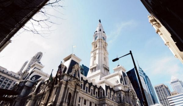
A call has gone out for proposals to cap a small portion of highway that runs though Philadelphia.
The Delaware River Waterfront Corporation (DRWC), a non-profit dedicated to planning and development along the Delaware River, has issued a request for qualifications for firms to assess the viability of a plan to build a park over Interstate 95. The park would connect the Old City neighborhood to Penn’s Landing, a waterfront plaza on the Delaware.
DRWC is seeking to assemble a team of engineers, planners and designers to distill project details, costs and preliminary design plans for evaluation by the end of 2013.
The park could provide “a seamless transition, a real connection” between the city and the Delaware riverfront, said DRWC project manager Karen Thompson. The proposal is part of DRWC’s Master Plan to redevelop the waterfront over the next quarter-century.
The Master Plan proposes an extension of the existing Race Street Pier to connect Chestnut and Walnut streets between Front Street and the river’s edge. A spacious, eight-acre green park will cover the 30-foot slope change from street to river, bringing extra green space to historic Old City.
Now approaching obsolescence, I-95 has snaked along the Delaware’s edge since 1979, cutting Philadelphians off from the waterfront. Pennsylvania needs to rebuild its part of the highway, which snags the state’s southeastern corner on the way from New Jersey to Delaware, by 2040.
Last year Next City held a forum about the possibility of removing, capping or converting the portion of the interstate that abuts Center City Philadelphia, instead of rebuilding a piece of infrastructure that many view as outdated. Thomas E. Deller, who represented Providence, R.I., highlighted the successful effort to reroute part of I-195 out of his city’s downtown, opening up 20 acres to redevelopment.
“People have the ability to enjoy the city,” he said, “to walk across and feel as if they are in a city not dealing with an interstate highway.”
Other successful examples of urban highway removal can be found across the country. Dallas last year completed a 5.2-acre park over the Woodall Rodgers Freeway, which had sliced the downtown in two. On an even greater scale, the once-elevated Embarcadero Freeway in San Francisco is now a six-lane boulevard with pedestrian walkways, trees, waterfront plazas and brand new residential buildings. Neighborhoods that used to languish in the elevated road’s shadow have seen increased commercial activity as new connections to the San Francisco Bay waterfront have brought more pedestrians to the area.
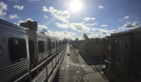
I-95 to the left, Delaware River to the right. Credit: Jason Paris on Flickr
Looking to these examples, is Philadelphia ready to reclaim its own waterfront?
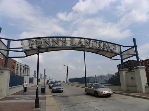
The highway cap has the potential to turn the frequently empty Penn’s Landing into more of a destination. For instance, Thompson explained, concerts and festivals held there wouldn’t feel so remote. “Instead of going to a show and then having nothing to do at the waterfront, the park and [commercial] developments along the basin will make it a site to stay at and enjoy,” she said.
The plan envisions mixed-use developments with mid-rise residential units and a variety of restaurants and retail on the ground floors to bring people and increased market value to the river basin.
“Making sure there is demand on the waterfront is as important, if not more important, than the connections,” said Andrew Stober, chief of staff at the Mayor’s Office of Transportation and Utilities. Currently, studies on market demand at the waterfront are underway to assess development options. “When great, attractive destinations are created, that creates demand.”
But with Philadelphia’s limited resources, can it be done? “We will have a better sense of the price tag after the study is complete,” said Stober.
Thompson broke it down further: “The site is divided into four elements,” she said. “The cap, the slanted park, the Market Street sites and the South Street Bridge developments around the basin. The team that we assemble will look at phasing and costs for each element.”
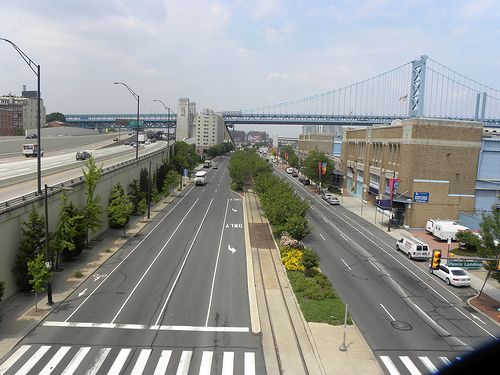
The highway cap would connect Penn’s Landing with Old City. Credit: Jason Paris on Flickr
Both Thompson and Stober highlighted new transportation infrastructure as a major part of the project. An analysis done by PATCO in 2010 looked at multiple configurations for connecting the waterfront with Philly’s existing transportation network. The best option — a light rail connection from the waterfront at Pier 70 up to Girard Avenue and access to Market Street — would successfully integrate the waterfront with Center City.
The capital costs for a project like this is in the half-billion dollar range. While the number of zeros is certainly discouraging, Stober said that waterfront transit expansion is included in Philadelphia’s 2035 long-range plan as a top transportation priority.
For Thompson, multiple transit options to and around Penn’s Landing Park would remove the barriers separating Philadelphians from the waterfront. “Right now it’s not technically that hard to get from Old City to the waterfront, as there are already bridges and caps,” she said. “But I-95 is [still] a physical and mental barrier…bringing the whole thing to Front Street will psychologically provide a better connection. The transportation planner [on the team] would flush out connections [to the existing system] to get more people to walk and bike over safely.”
No doubt there will be major challenges along the way. Thompson said that funding will pose the biggest hurdle. Many civic groups and government stakeholders are aware of the proposal and have been engaged in the process. They are mostly on the same page for now, but that’s bound to change as the cost studies pan out and specific funding questions emerge in the future.