In the 1970s, Seattle deployed a primitive mechanical contraption to measure traffic flow. As cars passed over pneumatic tubes in the street, the compressed air triggered a tape-puncher. At the end of the day, the city walked away with a roll of perforated paper, which was off-loaded to local companies, deciphered, and presented back to planners in graphs and charts.
The inefficiency attracted the attention of a couple of Seattle high-schoolers, Bill Gates and Paul Allen, who spent the next few years working on “Traf-O-Data,” a computer capable of directly reading the tapes. The project never reached fruition, but its creators used the experience to go on to start a very successful software company.
Today, car counts are the DNA from which road design and transportation planning emerge. Our methods of measurement remain simple, but they are cheap, accurate and widely used.
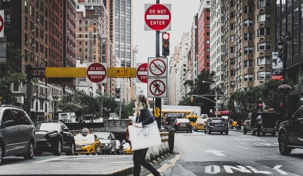
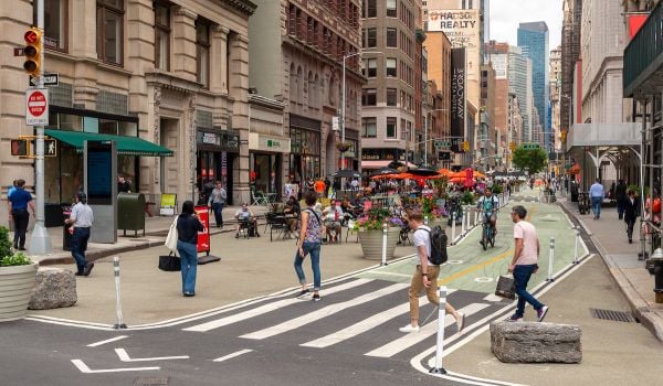
Keeping track of bicycles and pedestrians is another story. Few cities systematically measure where people are walking or biking, in part because planning has been ruled for decades by automobile interests. That’s changing now. But the various measurement techniques for non-motorized transport — infrared lenses, magnetometers, pressure sensors — are all in some way deficient. The dominant tools of pedestrian science? Eyes and a thumb-counter. It’s an imperfect and expensive method, and its shortcomings trickle into the designs of streets, parks, bike-share systems and bus networks.
Two new approaches, one to measure human presence, the other to predict it, threaten to put the man with the clipboard out of work.
“There’s a dire need for quantifying pedestrian flows in cities,” says Florent Peyre, founder and COO of Placemeter, a software company that analyzes camera footage for pedestrian counts. Its clients so far include business improvement districts, transportation departments and stores.
Human counts on busy corners, Peyre tells me, tend toward accuracy rates of just 70 or 80 percent. Placemeter’s video analysis, by contrast, has 95 percent accuracy in the daytime and doesn’t do much worse at night (especially in well-lit environments).
The technology is versatile enough, too, to work beyond specialized cameras and sensors. The company can use conventional security cameras to count passersby — without recording the video. That data can be used, in concert with weather forecasts, to predict seasonal shifts. On the hottest summer days, for example, Peyre says that foot traffic can shift into the shade by as much as 70 percent — crucial information for restaurants or shops that thrive on foot traffic.
At $99-$149 per month, setting up a measurement point is cheap. And yet, for cities with thousands of intersections, it still poses some of the same scaling problems as any other measurement tool.
What if what we already know about the locations of homes, streets and workplaces is enough to design a function for foot traffic?
That’s the aim of three transportation scientists at the University of Minnesota, who released a working paper last month with a model for pedestrian activity. Using metrics for economic accessibility (where jobs are), “betweenness network centrality” (a design-based estimate of likely routes pioneered by MIT’s Andres Sevtsuk) and auto traffic, the researchers attempted to predict pedestrian activity at over a thousand intersections in Minneapolis.
It was a bit like your typical algebra problem, in that the team, led by graduate research assistant Brendan Murphy, already had the right side of the equation in place — Minneapolis has a smattering of pedestrian and bicycle counts on file. They had to come up with an algorithm to best correlate known and easily accessible data (like jobs) with those elusive counts.
What they found isn’t shocking: Accessibility to jobs by walking and transit, auto traffic, and certain types of jobs (education, finance) are strongly correlated with increased foot and pedal traffic. But the particular results are less important than the general validity of the concept. Adjust a few coefficients, and you could potentially take the model to cities that don’t already have pedestrian data, and produce a citywide traffic estimate with just a few hours of work.
“There have not been a lot of pedestrian data models because there’s not a lot of data to calibrate them to,” says David Levinson, a co-author and professor who also runs the blog Transportationist. But that will change, he adds, as cities become more cognizant of walkers and cyclists. (See, for example, Placemeter.)
More data makes a better model, which could in turn be used in places where data is harder to obtain, like the megacities of the developing world. “You can take this type of model and apply it to a city where you have no data,” Murphy explains, “and from that predictive model you can inform urban planning decisions much, much better.”
The Science of Cities column is made possible with the support of the John D. and Catherine T. MacArthur Foundation.
Henry Grabar is a senior editor at Urban Omnibus, the magazine of The Architectural League of New York. His work has also appeared in Cultural Geographies, the Atlantic, The Wall Street Journal and elsewhere. You can read more of his writing here.
Follow Henry .(JavaScript must be enabled to view this email address)