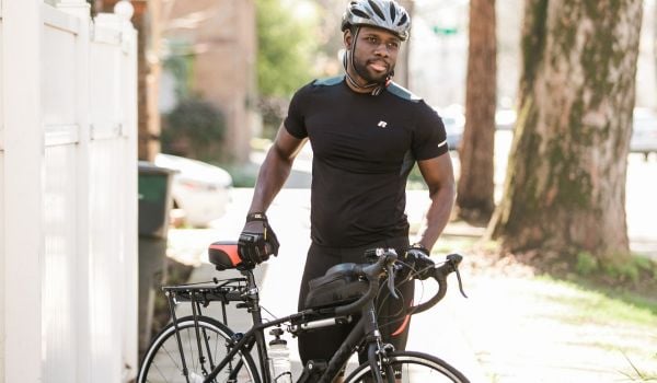
I realized recently that I don’t ride my bike as much as I used to. It wasn’t a conscious decision. I just started walking and taking transit and driving far more than I was choosing the bike, which had previously been my nearly-every-day mode of transportation. Somewhat ironically, I had this realization while riding my bike on Memorial Day. Or more to the point, it dawned on me why I haven’t been riding much.
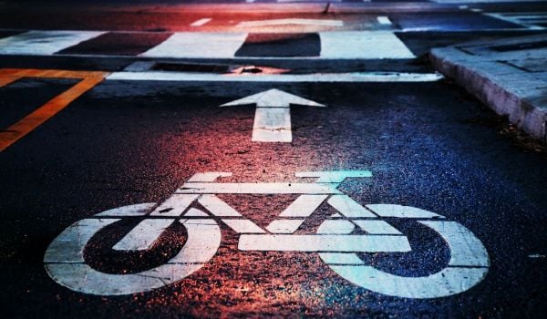
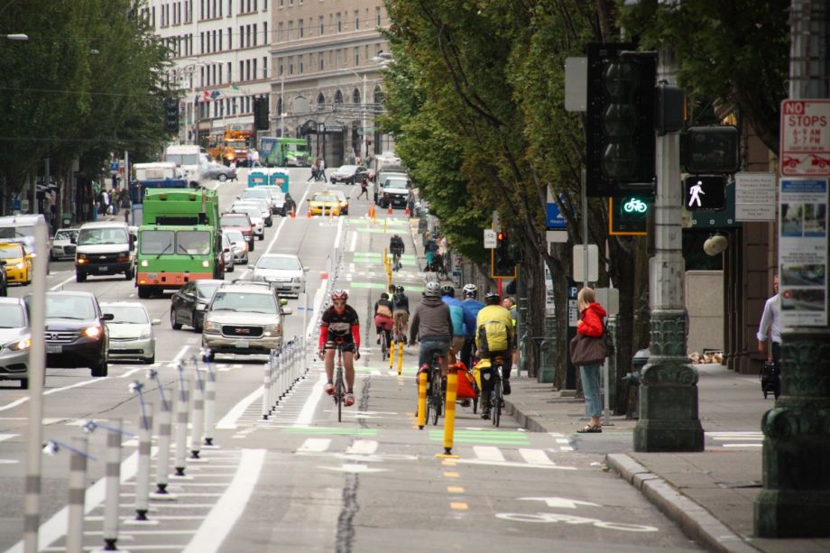
My partner and I were riding out to Golden Gardens, a beach park in the northwest corner of Seattle. After crossing through downtown (never the best experience on a bike), we connected to the new Westlake protected bike lane. After crossing the Fremont Bridge, we turned left on 34th Street. We did so in a two-stage, left turn bike box, which lets you make a slight right in the intersection, turn around, and wait for the light to turn green to go straight across, rather than trying to merge across two lanes of traffic to take a regular left. From there we rode in another protected bike lane, which dumped us onto the Burke Gilman multiuse trail.
Riding good infrastructure was just plain pleasant. Instead of pedaling with my head on swivel to make sure I wasn’t going to get run over, I was able to divert more attention to the sights around me, chat with my partner and enjoy being out on the bike on a sunny day. It occurred to me then that a major reason I was riding less these days is that I had moved to a corner of the city where there’s hardly any bike infrastructure, let alone high-quality protected infrastructure.
A year ago, we moved to Hillman City, a neighborhood in southeast Seattle’s Rainier Valley. There is a lot to love about the area, but bike infrastructure is not one of them. To bike just about anywhere beyond the confines of the neighborhood, you either have to ride on busy arterials with no bike infrastructure or take roundabout routes on residential streets that inevitably take you up and down far more hills.
The arterials aren’t terrible at off hours and on the weekend. (Except Rainier Ave., which is the flattest, straightest route north, but also happens to hold the record for most annual crashes and riding it feels like a death wish.) Beacon Ave. is wide. Lake Washington Blvd. is a popular enough bike route that drivers (hopefully) expect to share the road with bicyclists. But at rush hour, when they’re packed with cars, neither of those primary north-south routes is great. On gray and rainy days (of which we have many in Seattle), the lack of infrastructure tends to be the tipping point that pushes me on to bus or train.
To be fair, there are likely zero places to live in Seattle where one could ride in good bike infrastructure everywhere they wanted to go. The bike infrastructure network is still just too disconnected for that. But when I lived in Queen Anne and Ballard and Eastlake (all north-central neighborhoods) it was a lot easier to quickly connect to good routes. This is not coincidence. When Seattle started building out its Bicycle Master Plan, it prioritized the whiter, wealthier neighborhoods north of downtown. In part, this is because cyclists in those neighborhoods were lobbying for bike lanes. It was also because the city needed to show that its bike lane projects were successful and got used, so they built them in the neighborhoods where more people already identified as avid cyclists. The Rainier Valley is one of the most diverse areas of Seattle. In the 98118 ZIP code, 24 percent of the population is African-American, 30.5 percent is Asian and 10 percent is Latino or Hispanic, compared to citywide percentages of 7 percent, 14 percent and 6.5 percent respectively.
The legacy of that approach can be seen with a glance at the newest edition of the city bike map. From Interstate 90 north to about Green Lake, there’s an interwoven network of regular bike lanes, protected bike lanes, greenways and multiuse trails. In southeast Seattle, there are far fewer colorful lines marking the map.
It came as a bit of a surprise that I started caring so much about having good infrastructure to ride in. I used to ride anywhere and everywhere in the city. Bike lanes and trails were a bonus, but they didn’t dictate my route. As I’ve gotten older, however, I’ve gotten far less keen on trusting my safety to harried, distracted urban drivers.
I’m certainly not alone in my desire for safe infrastructure. Studies of protected bike infrastructure have found a correlation between safe infrastructure and ridership. When cities build a protected bike lane, it greatly increases the amount of bike traffic on that route.
The Seattle Department of Transportation has some plans in the works for better bike infrastructure in the Rainier Valley. The most significant is plans for a north-south neighborhood greenway that zigs and zags through quiet neighborhood streets from Rainier Beach to the I-90 bike trail. The city is slated to begin work on the greenway this year.
A signed, re-paved route with improved arterial crossings for bikes and pedestrians is a step in the right direction. But even its core proponents recognize an indirect (and sometimes hilly) route is not as ideal as a straight shot on an arterial with protected bike infrastructure.
“We’re psyched for neighborhood greenways in the valley,” says Gordon Padelford, executive director of Seattle Neighborhood Greenways. “But even though the greenway hasn’t been built yet, it’s already a little obsolete. Through Rainier Beach it makes sense, but the hills in Columbia City and Mount Baker just don’t make sense.”
There are other small improvements coming, including a protected bike lane running east-west between Columbia City and Beacon Ave. That is an important connection, but once you reach the top of Beacon Hill, it’s still mostly a bike-lane-free ride to downtown.
“We’re going to need a protected bike lane on Rainer to connect people to downtown Seattle where all the jobs are,” Padelford says. “But that is still a bit of a radical idea.”
Because it’s so flat and direct, Rainier Ave. would potentially be a dream route for bicyclists in the Rainier Valley. But I suspect a lot of people would be happy enough to ride to the top of Beacon Hill every day if there were protected bike lanes running east-west from the valley to Beacon Ave., and good north-south infrastructure waiting for them when they got there.
I haven’t completely given up riding. I still choose to bike once or twice a week to get me where I’m going. If I was working in a downtown office again, I would likely re-learn to tolerate the stress of rush hour bicycling and ride most days of the week. But I know I, and many of my neighbors, would ride a whole lot more if there were good, safe, protected infrastructure connecting southeast Seattle to the rest of the city.
Josh Cohen is Crosscut’s city reporter covering Seattle government, politics and the issues that shape life in the city.
Follow Josh .(JavaScript must be enabled to view this email address)