In an era of tight public budgets, cities need all the help they can get. Crowdsourcing is one strategy that cities can adopt to enlist the help, knowledge and time of their citizens. Applications like SeeClickFix have already shown how valuable crowdsourcing can be for tracking community and infrastructure issues. Now, two examples from California are showing how such an effort can work to help create and maintain other public data sets.
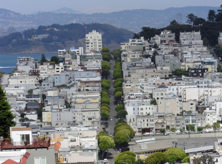
In San Francisco, a new website dedicated to documenting the city’s trees allows anyone to become a citizen urban forester. Starting with available public data (which usually only covers trees on public property), the website asks citizens to add or update information about a tree (or trees) in their neighborhood – including location, species, truck diameter and height. Visitors to the site can browse a map of all the trees in the constantly evolving database, and the site uses tree data to calculate the environmental benefits of a particular tree, or the entire city’s urban forest.
In Los Angeles, the city’s Office of Historic Resources is using its website to encourage public participation in its first-ever comprehensive survey of historic resources – called SurveyLA. Funded by the J. Paul Getty Trust, the survey will ultimately help guide the city’s conservation program. A major component of the initiative is public participation, and on the project’s website, the city has provided step-by-step guide for individuals and organizations who wish to participate in the survey. Citizens can also complete an online form to submit a historic resource in their community, while a mapping service for identifying existing historic structures and districts is in the works.
Both of these efforts are examples of projects that would likely be too large and expensive for city staff to complete and maintain on their own. But through involving the participation of citizens over time, it’s hoped that a relatively accurate (and most importantly, public) database of local resources can be compiled.
It’s possible that local governments could use similar approaches to help deal with property data and traffic surveys (following in the footsteps of OpenStreetMap). All that’s needed is for someone to take the first step.


_920_518_600_350_80_s_c1.jpg)