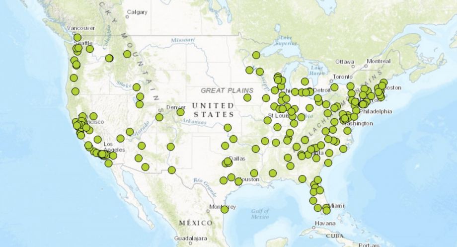
The U.S. DOT released Thursday the first version of its National Transit Map, an open data compilation of stops, routes and schedules from 270 U.S. transit agencies. Secretary Anthony Foxx announced the project in March by asking agencies to voluntarily submit data about their routes and schedules. Version one includes 10,000 routes and nearly 400,000 stops and stations submitted from about a third of all urban U.S. transit agencies with fixed-route service. The map includes 84 percent of the top 25 urban transit agencies, and 74 percent of the top 50. The U.S. DOT is hoping future versions will build on this data set.
The goal is to create a national map of transportation options that can support the DOT’s Ladders of Opportunity initiative, which provides grants to cities to improve transportation connections to jobs. According to a 2011 Brookings study, 70 percent of adults in U.S. metro areas live within three-quarters of a mile from a transit stop, but the typical resident can still only use that transit to reach 30 percent of jobs in 90 minutes or less.
“[We need] a clear understanding of the full reach and limitations of transportation in America,” Daniel Morgan, DOT’s chief data officer, told Josh Cohen in a Next City article earlier this year. “For the first time, it is possible for DOT to collect schedule data from a large number of agencies. By combining this data into a National Transit Map, we will be able to better understand and illustrate the role of transit in America, understand where gaps in service exist, and help connect more Americans to opportunity.”
As with many tech platforms designed by the federal government, the National Transit Map isn’t exactly sleek or intuitive. There are actually three maps: one of participating transit agencies, one of transit agencies by their number of vehicles in maximum service, and one of transit stops with an optional overlay showing the area within one quarter and one half a mile of a transit stop. But this map only shows stops, not routes or schedules. A user could measure how close a person lives to a transit station, but not where the route goes or how long it would take them.
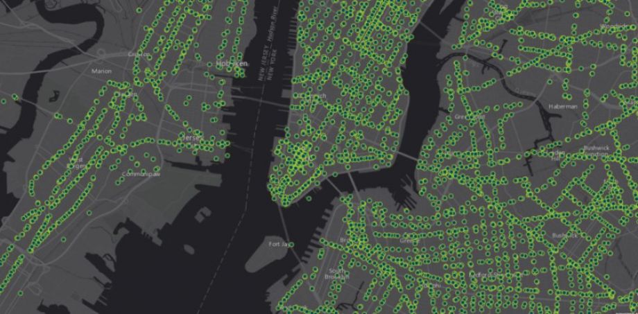
Screenshot of New York transit stops (Credit: U.S. DOT)
In a blog post announcing the map’s release, Secretary Foxx wrote that he wants the public to dive into all of the data for both their own projects and to help inform the DOT.
“Data is most powerful when we put it into practice,” he wrote. “We hope you translate this important data for Americans who need to use local transportation systems to get to jobs, education, medical care, grocery stores and other key services.”
Jen Kinney is a freelance writer and documentary photographer. Her work has also appeared in Philadelphia Magazine, High Country News online, and the Anchorage Press. She is currently a student of radio production at the Salt Institute of Documentary Studies. See her work at jakinney.com.
Follow Jen .(JavaScript must be enabled to view this email address)