Humans first visited the Katy Prairie around 10,000 years ago. The prairie lies in what is now known as the Texas Coastal Plain, bound by the Brazos River on the southwest, pine forest on the north, and the city of Houston on the east.
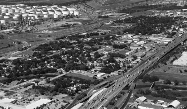
Over those thousands of years, the land was used increasingly for hunting and farming by Native Americans, pioneers, cattle ranchers and rice farmers. Beginning in the 1980s, a new group arrived: suburbanites. As Houston grew, developers started constructing master-planned communities on what remained of the undeveloped portions of the Katy Prairie. From 1978 to 1983, 100,000 acres of Katy Prairie were converted to urban use.
The formation of the Katy Prairie Conservancy in 1992 helped protect the land, 200,000 acres of which were undeveloped at the time.
In the wake of Hurricane Harvey, which hit in August of last year, some Houston conservationists are urging that the city consider prairies as a tool for a more resilient city in an era when climate change is fueling more powerful and more frequent major storms.
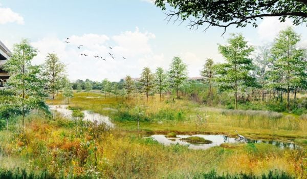
Prairies are the kind of land that soaks up rain, a “super-effective urban sponge,” as Laura Huffman, regional director of the Nature Conservancy in Texas, puts it.
The benefit of such land in an urban context has long been understood, according to MaryAnne Piacentini, president and chief executive officer of the Katy Prairie Conservancy, “but it only has begun to be heard,” she says.
Piacentini and Huffman point to Houston’s “Memorial Day Flood” in 2015, the “Tax Day Flood” in 2016, and finally Harvey as contributing to the urgency surrounding resiliency. “In order to keep people safe, in order to keep properties preserved, we have to start thinking differently,” says Huffman.
Post Harvey, it was widely pointed out that Houston’s growth — dependant on policies that encouraged development in flood-prone areas while reducing the region’s natural defenses to flooding — exacerbated the storm’s devastation.
The area around Katy Prairie was a case in point. Developments overlapped or abutted floodplains, and local officials hadn’t done enough to preserve the native grasses, set aside open spaces or improve drainage. Damage around Katy, according to the New York Times, was not restricted to floodplains identified by FEMA.
Prairie proponents are looking at different ways the land could be integrated into the city’s resiliency plan.
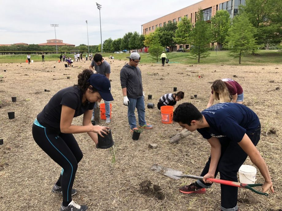
Advocacy has risen for urban “pocket” prairies, which have increasingly popped up around Houston in places like hospitals and high schools. This spring, students at Rice University spearheaded a plan in partnership with the Nature Conservancy and Katy Prairie Conservancy to restore a portion of the coastal prairie habitat and integrate it as part of the college campus.
There’s another major opportunity in the form of the $2.5 billion flood bond approved by 85 percent of Houston voters this August. It allows the Harris County Flood Control District to build at least 230 resilience-centered projects over the next 10 to 15 years.
“There are a lot of projects that show a willingness for border preservation — figuring out how much land on either side of our creeks and bayous ought to be protected — as well as buyouts, to take people out of harm’s way and permanently protect that land as open space,” says Piacentini.
To better advocate for green infrastructure, Katy Prairie Conservancy has worked with partners, including Rice University, to study how prairies and wetlands can absorb and slow down floodwaters. The Nature Conservancy, too, is conducting research across the country to determine how nature can help reduce the impact of flooding.
“It’s very hopeful that in the work we’re doing … we can bring science behind us and show the cumulative value that we provide,” Piacentini says.
At Harris County Flood Control, there’s more reservation with regard to urban prairies. A study conducted by the Harris County Flood Control District between 2013 and 2016 revealed that native prairies were unable to absorb 100 percent of runoff in smaller storm events, though they performed better than developed land.
“Can we rely on this landscape as a flood reduction tool?” asks Stephen Benigno, an ecological restoration practitioner with the Harris County Flood Control District. “Not 100 percent, which is not to say we shouldn’t. But there’s still a limit to how much water the soil can hold.”
Prairies aren’t the only green infrastructure the Harris County Flood Control District is studying in regards to flood reduction, Benigno notes. The county is also looking into the potential of bioswales, native vegetation and floodplain preservation.
Still, there are challenges ahead. Benigno points to the difficulty of acquiring the land that green infrastructure requires. “On any given year there’s a budget we have to stick to — we can’t go out and buy every piece of floodplain in one year,” he says.
Despite challenges, awareness around green infrastructure is on the rise. “We are trying to normalize the concept,” says Huffman. “It’s the ability to get projects on the ground and cultivate the science, to squeeze out the risk of these strategies for when the public sector is ready to invest.”
She points to a recent study in which scientist found that native wetlands prevented $625 million in property damage from flooding during Hurricane Sandy and that restoring natural elements like wetlands and reefs could help avert more than 45 percent of the climate risk over a 20-year period, saving more than $50 billion in flood damages.
Huffman believes that intuitively, “people know that if you don’t have a parking lot, but you have a prairie, you’ll get two different outcomes.” Integrating that into real policy remains an uphill battle, she and Piacentini admit.
“Understanding it at an intuitive level is different than incorporating it into an actual capital improvement program, where you’re making hard choices about where pipes go, and where prairies go,” says Huffman. “We’re moving toward showing people how practically, it can be incorporated post-Harvey.”

Emily Nonko is a social justice and solutions-oriented reporter based in Brooklyn, New York. She covers a range of topics for Next City, including arts and culture, housing, movement building and transit.
Follow Emily .(JavaScript must be enabled to view this email address)


_1200_700_s_c1_600_350_80_s_c1.jpg)