_920_560_80.jpg)
Last year, Toronto redesigned a four-lane downtown street, shifting traffic and creating a now popular pedestrian promenade. With U.S. cities increasingly retrofitting busy streets to include protected bike lanes, Philadelphia soon expects to invest $500,000 in such cycling infrastructure. To help planners, Portland State University’s Transportation Research and Education Center is now working to develop a set of best practices for protected bike lane intersections. Amid this evolving streetscape, the National Association of City Transportation Officials (NACTO) is now offering a guide for cities looking to incorporate public transit onto existing streets, from neighborhoods to busy corridors. Shared transit right-of-ways, active transportation lanes and safe intersections that allow all transit modes to intersect peacefully are all detailed in the Transit Street Design Guide. The guide complements NACTO’s Urban Bikeway Design Guide and Urban Street Design Guide, both of which advise cities on creating multimodal streets.
With the new guide, NACTO focuses on strategies to prioritize transit on existing urban right-of-ways. For smaller neighborhood streets, the guide suggests improvements like better curbside management using bump-outs, more thoughtful treatment of transit stops, designated spaces for deliveries and drop-offs, and fair prices for on-street parking, to lessen demand. For wider arterial corridors, which are often signed for higher-speed traffic, the guide recommends designating lanes for different uses, like protected bike lanes and dedicated bus lanes. Creating exclusive transit space is recommended for mixed-use downtown streets too, as well as fixes to make transit more efficient: creative use of one-way streets, traffic signals specifically for transit, stations with platforms level to the curb, longer spacing between stops and all-door boarding.
_920_438_80.jpg)
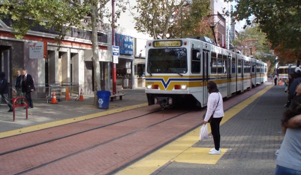
An in-street boarding island for a streetcar (Credit: NACTO)
_920_511_80.jpg)
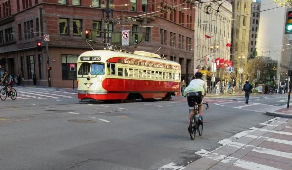
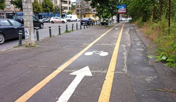
A cycle track passing behind a bus boarding island (Credit: NACTO)
The guide also has specific advice for waterfronts, parks and other “edge conditions,” where limited vehicular crossings allow for higher traffic capacity with less opportunity for conflict. And it gets into the nitty-gritty of designing curbs that allow transit vehicles to get extra close, boarding islands that are elevated to provide accessible boarding for those in wheelchairs, and turn lanes that discourage cars from idling in the intersection while they wait for buses to board. It also advises cities on the use of contraflow transit lanes, in which one direction of a two-way street is reserved for transit vehicles, and green transitways, which provide large planted areas along and between tracks and allow for better stormwater management.
The guide will also soon be available on the organization’s website.
Jen Kinney is a freelance writer and documentary photographer. Her work has also appeared in Philadelphia Magazine, High Country News online, and the Anchorage Press. She is currently a student of radio production at the Salt Institute of Documentary Studies. See her work at jakinney.com.
Follow Jen .(JavaScript must be enabled to view this email address)