Welcome to “The Mobile City,” our weekly roundup of newsworthy developments in urban transportation.
It’s Time for Texas DOT to Tear Down Freeways, Not Build Wider Ones, Article Argues
The movement to deconstruct rather than reconstruct freeways has had some notable successes, especially in San Francisco and Milwaukee, where the removal of never-completed freeway stubs touched off waves of reinvestment in both cities and reduced traffic to boot.
Now, The Texas Observer recommends that one of the most notoriously congested freeways in the country be removed, too.
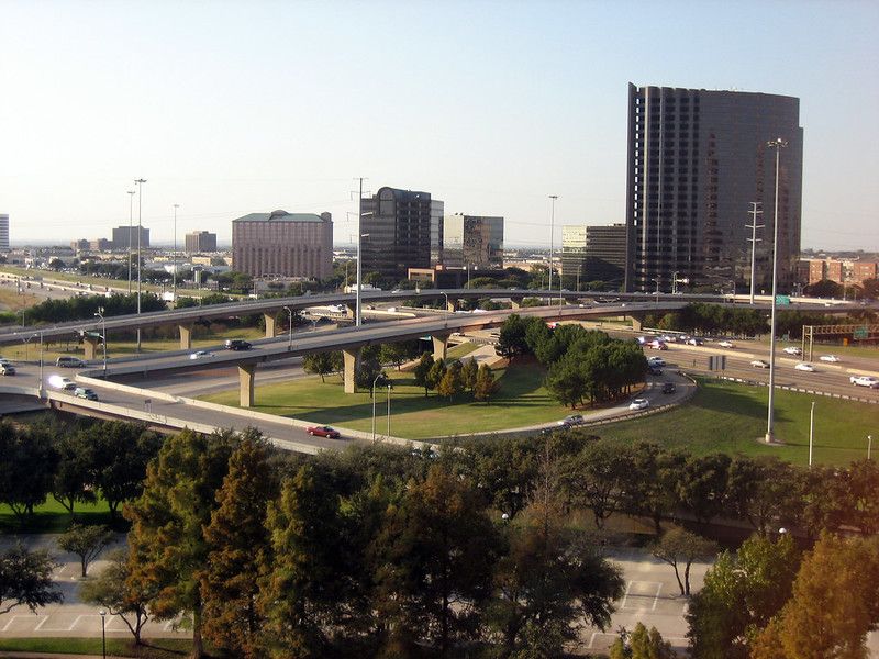
The freeway is I-35 in Austin, the principal (and only toll-free) freeway through the center of the booming Texas capital. Drivers there spend as much as 90 minutes, or even longer, getting from communities where they can afford homes to jobs in or close to the city center. And the Texas Department of Transportation (TxDOT) proposes to ease the pain by adding managed lanes to the highway, which carries more than 200,000 cars a day. Its proposal for widening I-35 through central Austin calls for adding eight lanes in all to the freeway and its frontage roads, bringing the total number of lanes to 20.
This $7.5 billion project represents just one piece of the $25 billion TxDOT has committed since 2015 to freeway-widening projects. The Texas Observer feature “The Road Home” asks, “What if we tore them down instead?”
The answer it comes up with is: We would probably see traffic congestion fall, not rise. We would be able to repair the damage caused by freeways that severed communities, especially communities of color the freeways either sliced through or cut off from the rest of the city. And we would create more valuable land where it was needed most.
As an example of what might happen once the freeways disappear, the article cites the one place in Texas where TxDOT plans to remove a freeway: Dallas’ Deep Ellum, a historically Black neighborhood known for its music and entertainment scene before a short elevated freeway now signed as I-345 carved it up in the 1950s. TxDOT came around on removing this highway when Dallas business leaders were persuaded that doing so would free up $9 billion worth of land for redevelopment, resulting in $255 million in additional property tax revenue. On top of that, the land freed by removing the highway has the capacity to support 59,000 jobs and 26,000 new housing units. Meanwhile, TxDOT’s own simulation showed that congestion would rise by only one percent with the freeway gone.
The effort to remove I-345 even managed to change the thinking of some people in TxDOT. Here’s how Mo Bur, the department’s Dallas district engineer, put it: “We’re not here to move cars. We’re here to have a project that will address all kinds of transportation. And then, once we leave, what does it do to the community that the highway went through?”
The trouble is, this thinking flies in the face of roughly a century of transportation planning in the Lone Star State. And on top of this, the state forbids the use of gas tax revenues for anything other than building and maintaining highways, and many Texans consider spending money on alternate forms of transportation either a waste or, as one pro-highway advocate quoted in the article put it, “a socialistic attempt to get me out of my vehicle.” As a result, such improvements in alternate transportation as occur in Texas are purely locally financed affairs, buttressed by federal support where local authorities can get it.
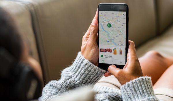
Need to Get Around Pittsburgh? There’s Now an App for That
The Holy Grail of transportation-tech developers has been “mobility as a service,” or “MaaS” — technology that would allow people to figure out the best way to get where they’re going, plan their trip, and pay for it, regardless of mode, all in a single app.
The Pittsburgh CityPaper and Streetsblog USA both report that this Holy Grail is now available to Pittsburghers.
This first-in-the-country mobility-as-a-service app is called Move PGH, and it’s based on a widely-used transit-planning app called Transit. Part of a pilot program launched on June 9, Move PGH combines the app with “mobility hubs” around the city where residents can rent bikes, mopeds or e-scooters, and eventually e-bikes as well. These hubs are also connected to Port Authority of Allegheny County bus and trolley stops and stations.
Users of the MovePGH app can obtain mass transit schedules and pay their transit fares in advance, locate and pay for micromobility vehicles, find a carpool, and even reserve car-share vehicles if they determine that is what they need.
By relying on a third-party app rather than attempting to build one from the ground up, Streetsblog reports that the city of Pittsburgh solved the trickiest problem: how to price an entire multimodal trip, allow a user to pay for it all at once, and then allocate the revenue among the various service providers.
“The goal, eventually, is seamless fare integration,” Karina Ricks, director of the Pittsburgh Department of Mobility and Infrastructure, which initiated the project, told Streetsblog. “What we want, over time, is to be able to say, ‘This transportation network and everything in it, it’s all one system, and your trip’s gonna be a flat $3, end to end, even if you’re using three different [shared] modes along the way.’ We can parse out the revenue we take in among the different operators on the back end, so the user doesn’t need to worry about that. We can implement a subsidy on parts of that journey if a rider is low-income, or to encourage them to use something more sustainable. We can do all that for them, and make it as easy as possible — because all the user wants is to get from where they are to where they need to go.”
The two-year pilot program relies on a partnership of five micromobility providers to make this seamless experience work. Those are scooter-share company Spin, car-share company Zipcar, local bike-share operator Healthy Ride, carpool app Waze and moped provider Scoobi, all of which have exclusive operating rights within the city for the next two years, with the city setting the goals for the program but not paying a cent for its operation.
There’s already a decent user base in place: the Streetsblog article notes that 40,000 Pittsburghers already use Transit, and 79 percent of those users do not own a car.
In many ways, Pittsburgh is the ideal city for launching MaaS. Another CityPaper article noted a 2019 CityLab survey that found that Pittsburgh ranked 11th among all metro areas of 1 million or more for the willingness of residents to get around without a car. In the city itself, more than 17 percent of Pittsburghers commute via public transit, and 11 percent walk to work, putting it in the top 10 U.S cities for walk share of commuting (and the city’s hilly terrain means those walkers are probably some of the fittest individuals in the country). And while only two percent of city residents bike to work, that share has doubled in the past decade. And finally, a 2020 study by a car-insurance comparison-shopping website ranked the city as the seventh least car-dependent in the country. “Pittsburgh isn’t on the same level for non-car transit as New York City, San Francisco, or Washington, D.C., but for a city its size, and one in a Rust Belt region, Pittsburgh punches well above its weight,” the article notes.
Study Finds Bike-Share Gap, Hints at Ways to Close It
The road to transportation equity ought to have bikes on it, but as of now, it doesn’t, according to a study reported on in Bicycle Retailer and Industry News.
The study found that bike infrastructure was not spread evenly across the 29 U.S. cities it studied.
Researchers Nicholas N. Ferenchak of the University of New Mexico and Wesley E. Marshall of the University of Colorado examined the distribution of 11,010 miles of bike facilities provided between 2010 and 2019 in the 29 cities and found that the installations were highly tilted towards white neighborhoods. Lower-income white Census block groups, which the researchers said were likely to have more people who would make use of active transportation facilities, had 45.9 percent more bike infrastructure installed than block groups where low-income people of color, who have similar needs, dominated. And they also had 46.2 percent more bike infrastructure installed than higher-income POC block groups.
The study attributes the difference to worries about gentrification. Many articles have been written that portray bike lanes as vectors of gentrification and displacement, and this report specifically mentions two of them. But the researchers found no significant causal link between bike infrastructure and gentrification.
The Better Bike Share Partnership, a group pushing for better access to micromobility in low-income communities, discussed the study on its own blog. “There’s definitely a narrative that bike infrastructure leads to gentrification and displacement, or that it’s a sign of it, and the evidence supports the finding that Black and brown communities have less bicycle infrastructure,” said Better Bike Share Partnership Manager Zoe Kircos. “We have heard anecdotally that people in these communities don’t want bicycle facilities because of the concern over displacement.”
The study suggests that the way to close this gap is to engage with and involve communities in the planning and development of bike infrastructure in order to learn and address their needs and concerns.
Know of a development that should be featured in this column? Send a Tweet with links to @MarketStEl using the hashtag #mobilecity.
Editor’s note: This story originally misstated that The Better Bike Share Partnership commissioned the study about bike infrastructure. We’ve corrected the error.

Next City contributor Sandy Smith is the home and real estate editor at Philadelphia magazine. Over the years, his work has appeared in Hidden City Philadelphia, the Philadelphia Inquirer and other local and regional publications. His interest in cities stretches back to his youth in Kansas City, and his career in journalism and media relations extends back that far as well.
Follow Sandy .(JavaScript must be enabled to view this email address)
_600_350_80_s_c1.jpg)