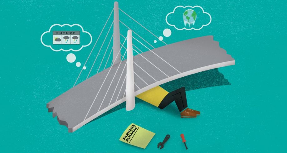
For the first time, engineers have started to look at projections for how future conditions may stress infrastructure, and not just rely on historic data to design new projects. In this week’s Forefront, Bill Lascher sets out to see how this new way of building is reshaping not only tunnels and bridges, but also the way policymakers budget and plan for growth.
Two huge towers rise from the Willamette River. Taut cables stretch from each, suspending huge slabs of concrete and rebar like scales of justice hung across the waterway.
Crowding this river bisecting Portland, Ore., the towers stand about halfway between a stretch of Interstate 5 known as the Marquam Bridge and the Ross Island Bridge carrying U.S. Route 26 over the Willamette. Once, riverboats plied these waters. Later, cars chugged high above them. Then came the belching fumes of tractor-trailers and lanes packed with even more honking drivers. Now a new bridge is rising, one that may end up best known for the absence of exactly those things.
The 1,700-foot-long span rising from the river will be a conduit for light rail, pedestrians, bikes, buses and, eventually, streetcars — essentially, everything but automobiles. It will be Portland’s first crossing, and one of the first large-scale transportation projects in the country, consciously engineered with future climate change impacts baked into its plans.
This still-unnamed bridge will become the first Willamette crossing in 40 years and the 12th in Portland’s history. TriMet, the regional transportation authority, has budgeted $134.6 million for a piece of infrastructure it believes will be able to withstand intense climatic changes that the area will confront over the next century.
Here in the Pacific Northwest, glaciers atop the towering Cascade Range are melting, their waters flowing toward the Columbia River and the sprawling, intensely managed riverine system that feeds it. Along with the meltwater and rising sea levels, storms in this already-damp corner of the U.S. are getting wetter and more intense. All this water trickles down to one reality: The river that engineers thought they were dealing with when they started building Portland’s new bridge won’t be around for much longer. Recent data shows surface water models shifting more quickly than ever, with more rain falling over shorter periods of time than it had in the past.
Conservative estimates suggest the Willamette could rise nearly four feet by 2099. As the waters rise and storms intensify, the river’s faster, more forceful flow will erode the soil around the bridge’s support structures. In 2010, bridge designers confronted these projections and redrafted the structure they had spent years modeling. They overhauled the structure to give more room to passing ships and strengthen it against faster-flowing waters. The bridge going up today is three feet higher than originally designed. That small difference in height comes with massive financial costs and implications for the future of infrastructure engineering.
Portland’s projected climate change impacts are comparatively less catastrophic than those foreseen in other cities — think of how Hurricane Sandy caused hundreds of millions of dollars in damage to New Jersey Transit trains that were placed in low-lying yards, or how the storm inundated New York City’s subway stations and tunnels with powerful torrents. Yet Portland’s new bridge offers a revealing glimpse at what one of the nation’s top transportation engineers, Michael D. Meyer, calls a complete “cultural shift” in how infrastructure is planned and built.
If you build new infrastructure today, “you need to do it differently,” says Meyer, co-author of the transportation chapter of the White House-commissioned 2013 National Climate Assessment. For the first time, engineers have started to look at projections for how future conditions may stress infrastructure, and not just rely on historical data to design new projects. Call it smart design or next generation infrastructure. Whatever the jargon, this new way of building is reshaping not only tunnels and bridges, but also the way policymakers budget and plan for growth.
To read more, subscribe to Forefront. Already a subscriber? Click here to continue reading.